The short answer
Start a fictional region map with a journey: an origin, a destination, and an obstacle that changes the route. Add the places and connections the story needs, mark scale and uncertainty, then test what happens when a crossing closes. Distinguish your author map from maps characters can access.
Your characters need to carry a message from a river town to a hill settlement before a meeting. Begin the map with that problem. Drawing every coastline first may be enjoyable, but it will not necessarily answer whether they can cross the river or who controls the road. A map answers where the crossing is. Worldbuilding questions covers the questions around it, from who may refuse the boat to how people count the day.
The following sketching method is for narrative planning. Its landscape and travel assumptions are invented. It is not a substitute for geographic research when your story depends on real terrain, weather, or transport.
Place the journey before the decoration#
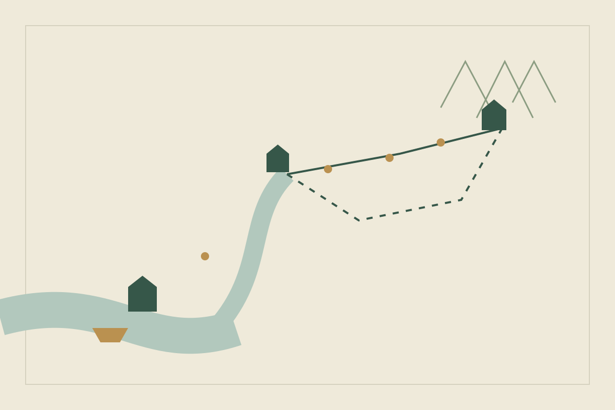
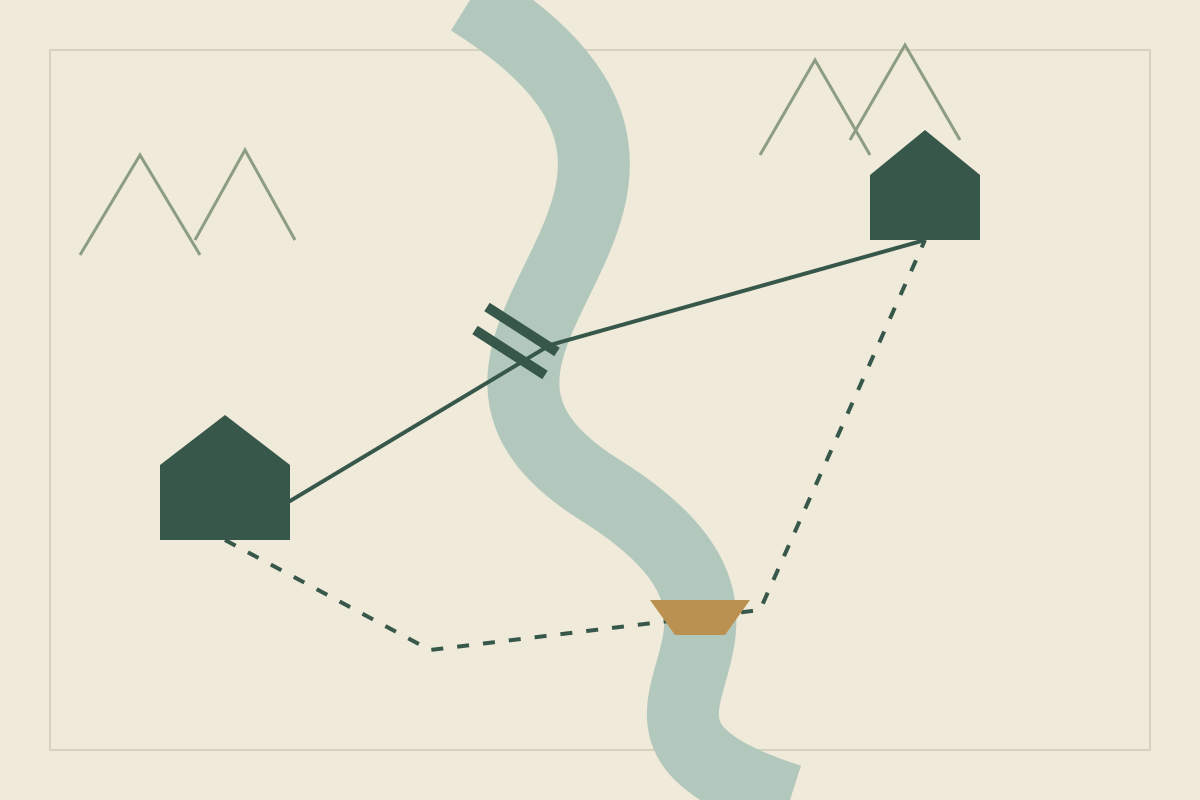
Draw two dots for the town and the settlement. Put a river between them and mark one bridge. Add a longer route to a ferry. You now have two choices whose consequences can differ.
Give each route a reason to exist. Perhaps the bridge serves carts while the ferry connects smaller riverside communities. Decide who maintains each crossing and who can refuse passage. These details turn a line on paper into something a character must negotiate.
Record what distance does and does not tell you#
Choose whether the sketch has a scale. If it does not, label it as schematic in your notes and avoid measuring it as though it were surveyed. If it does, use the same distance convention throughout.
Distance alone does not settle a scene’s duration. Record your chosen assumptions about transport, stops, access, and delays. For this invented journey, you might decide the bridge route fits within one day while the ferry detour requires an overnight stop. Those are story constraints to check, not universal travel rates. How to calculate travel times in a fantasy world turns a scaled route into days on foot, on horseback, by wagon, on a river and at sea.
Add only places that change a decision#
A shelter matters if the detour requires sleep. A checkpoint matters if the messenger lacks permission. A second village matters if someone there can provide help or pass on news.
For each addition, ask what choice becomes possible or impossible because it exists. Keep decorative locations on a separate layer or list until they affect the story. This keeps the working map readable while leaving room for a richer finished illustration.
Close the easiest route#
Now remove the bridge temporarily. Can the character still arrive? Who benefits from the delay? Does a companion know another crossing? Follow the effects through the timeline, including when the closure becomes known.
If every obstacle disappears because you can draw another road, establish what prevents that escape before the scene needs it. The limit might be access, distance, a closed border, or simply the character’s incomplete knowledge. Make it consistent with the story you have already told.
Walk the messenger through the ferry detour#
The bridge is out, the meeting at the hill settlement starts at noon the next day, and the messenger leaves the river town at dawn. Write each leg of the detour as an assumption you chose, then note what could break it.
| Leg | Your assumption | What could break it |
|---|---|---|
| Town to the ferry landing | Most of the day on foot along the bank | A flooded path |
| The crossing | The ferry runs only in daylight | The ferry keeper refuses passage |
| Night at the shelter | Open to any traveler | Full, or barred to strangers |
| Shelter to the settlement | A morning’s climb past the checkpoint | The messenger lacks a permit |
On these invented assumptions, the messenger arrives with a little time to spare. That margin is the scene’s pressure. If the walk runs late, the last ferry has gone; if the checkpoint stalls, the meeting starts without them. Choose which entry the story spends rather than inventing a new obstacle on the spot.
Then test the detour against the scene:
- Where is the messenger at nightfall, and what can they see from there?
- Who else waits at the landing, and what do they want?
- Does the message survive an open boat? The bridge never raised that problem.
Common map mistakes and how to fix them#
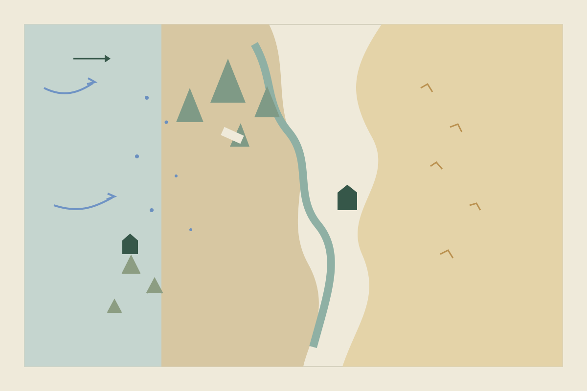
- Rivers that ignore the slope. Water runs downhill, and rivers usually join on the way to the sea rather than split, deltas being the familiar exception. If your river divides long before it reaches the coast, or links two seas, redraw it or decide what in your world allows it.
- Settlements with no reason to be there. Towns tend to grow where people already stop: at a crossing, a ford, a harbor or reliable water. The river town probably grew around its bridge, so losing it hurts. Once that reason is a shelf, a spring or a wall the town has outgrown, designing a fantasy city that feels lived in follows the wards, the water and one morning. If the stop is a herd that must drink there, creating fantasy creatures that fit their ecosystem asks what the animal eats on the way and who depends on that path.
- Barriers that are all or nothing. A mountain range drawn as a solid wall either stops the plot or gets ignored. Real ranges have passes, so give yours one or two, each with a cost: a toll, a guide, a season when it closes. The same range can also decide which side is wet. How to design a believable climate for a fantasy world puts the wind and the rain shadow on the map before the towns.
Match the map to the story’s scale#
A short story on one road may need no drawing: a list of places in order, with the time between them, can be enough. In a series, leave some regions deliberately blank so later books have room, and note which places and distances are already on the page. The method carries across genres: in a science fiction settlement, the crossing might be an airlock or a supply run.
Whether readers see a map is a separate choice. In our editorial view:
| If your story… | Consider |
|---|---|
| Moves through many places readers must follow | A simple reader map showing only places named in the text |
| Depends on a route the characters find later | Leaving it off the reader map, or printing the protagonist’s flawed copy |
| Stays in one town or on one road | Prose directions, with the map kept for planning |
A printed map is a promise readers can check scenes against, so it must obey your working map’s assumptions.
Keep author knowledge separate#
Your planning map can include a hidden path. A map purchased by the protagonist may omit it. Label whose map you are looking at, when it was made, and what it gets wrong. An omission is only a useful plot device if the character has a plausible way to discover it.
Once the route works, use a small naming pattern to connect its places. If you want to organize articles around an existing map image, the Obsidian and World Anvil comparison explains the different documented starting points without treating either as a drawing tool.
Keep the map’s story notes in Yazar.io#
Yazar.io is not a map editor, so draw the region in the tool you prefer. For everything the drawing cannot hold, it is a good companion. Give each settlement and crossing a location entry, attach your map sketch as an image (an entry can hold several), and record who controls each route and what crossing requires (updates).
Mention the crossing by name in the entries of the people who depend on it, and its backlink panel lists all of them (features). When the crossing closes, that list tells you whose journeys and scenes need the ferry detour. Record why the detour matters to the current scene in the crossing’s entry, where you will look for it next time.
Update, 10 October 2026: Added a worked example on the ferry detour, common mistakes, and guidance on scale and reader maps, and expanded the Yazar.io section with specific features from Yazar.io’s public pages. On 8 October 2026, a topic-specific Yazar.io suggestion had been added.
Update, 21 October 2026: Added a link to the worldbuilding questions checklist.
Update, 25 October 2026: Linked the guide on fantasy creatures that fit their ecosystem, for a herd whose path depends on water.
Update, 26 October 2026: Linked the guide on calculating travel times, for turning a scaled route into days on foot, on horseback, by wagon, on a river and at sea.
Update, 27 October 2026: Linked the guide on designing a believable climate, for the wind and the rain shadow on a range.
Sources
- Yazar.io: Description of the service · October 8, 2026
- Yazar.io: Features · October 10, 2026
- Yazar.io: Product updates · October 10, 2026